Dark-sky survey, spring 2025
- type
- research-source
- independence
- first-party
- published
- 2025-04-28
- accessed
- 2025-05-14
Nine fixed stations measured on one clear, moonless night by four members of the Millbrook Astronomical Society. Each station took three readings with a handheld sky-quality meter; the table reports the median.
| Station | Place | Reading (mag/arcsec²) | Approx. Bortle |
|---|---|---|---|
| S1 | Southern allotments | 21.6 | 4 |
| S2 | North field edge | 21.3 | 4 |
| S3 | Riverside meadow | 20.4 | 5 |
| S4 | High Street, Market Row | 18.7 | 7 |
| S5 | North-east lane | 21.5 | 4 |
| S6 | Recreation ground | 19.2 | 6 |
| S7 | Eastern bypass verge | 21.4 | 4 |
| S8 | Southern bypass verge | 21.7 | 4 |
| S9 | Market Row car park | 19.0 | 6 |
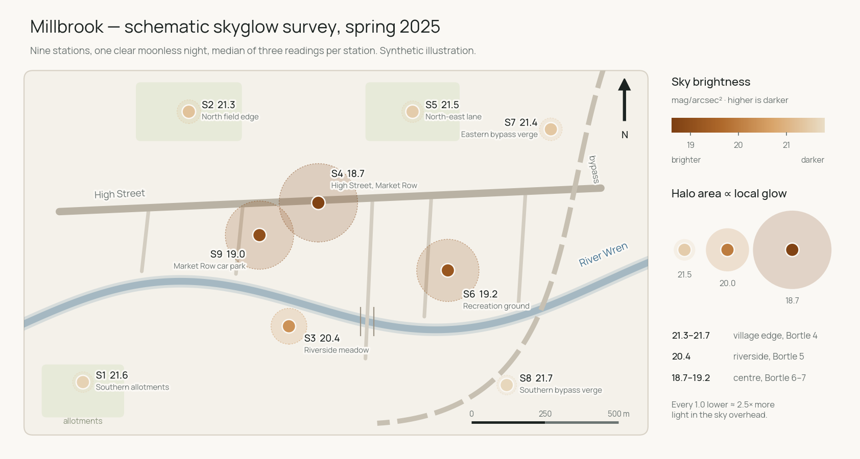
The full map is the survey schematic. It shows skyglow falling away from the high street and two local halos at the recreation ground and car park.
Limitations: one night, one season, uncalibrated consumer meters, no cloud or air-quality record, and no repeat at the same stations. Treat the pattern as a working baseline, not a trend.